Sugarloaf Peak/San Juan Trail
 Road Maps and Parking
Topographic map
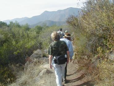 The trail to Sugarloaf Peak alternates between forested regions
and open chaparral. Sugarloaf Peak is not a major mountain. It
is just a hill (not the mountain in the background of this photo!) that
happens to be at a convenient turn-around
point. There is a good view from there, extending all the way to the
ocean, even though the trail does not go to the top. The return path is
the same as the outbound path. The round trip distance is 10 miles, and
the sum of the elevation gains is around 1000 feet. Much of the elevation gain
occurs near the end of the hike, but it is a gentle climb. The entire
hike is on the San Juan Trail. The trail continues on to the Ortega
Highway, but the full round trip is too much for one day.
The trail to Sugarloaf Peak alternates between forested regions
and open chaparral. Sugarloaf Peak is not a major mountain. It
is just a hill (not the mountain in the background of this photo!) that
happens to be at a convenient turn-around
point. There is a good view from there, extending all the way to the
ocean, even though the trail does not go to the top. The return path is
the same as the outbound path. The round trip distance is 10 miles, and
the sum of the elevation gains is around 1000 feet. Much of the elevation gain
occurs near the end of the hike, but it is a gentle climb. The entire
hike is on the San Juan Trail. The trail continues on to the Ortega
Highway, but the full round trip is too much for one day.
At about 1½ miles the path crosses an older path. Continue
straight ahead there.
At 2 miles the trail passes through a small and relatively flat grassy
area (usually called potreros in this region), and just after that the
Chiquito Trail branches to the left.
It is marked by a sign, and continue straight ahead. Still further along
the Viejo Trail, also marked, joins on the left, but stay on the main trail.
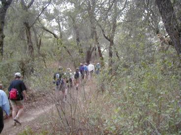 If you have not hiked in this region before then it is probably better
to begin with the trails that start from the candy store, and several
are documented above. Those trails are more accessible, but after a
while when you need some variety you will find that each trail has
something unique to offer. For example, while I didn't bring back and
good photos of them, there are some very old and impressive oaks near
the end of the outbound leg of this hike.
If you have not hiked in this region before then it is probably better
to begin with the trails that start from the candy store, and several
are documented above. Those trails are more accessible, but after a
while when you need some variety you will find that each trail has
something unique to offer. For example, while I didn't bring back and
good photos of them, there are some very old and impressive oaks near
the end of the outbound leg of this hike.
Home