 Access Roads and Parking
Topographic Map
Elevation Profile
Access Roads and Parking
Access Roads and Parking
Topographic Map
Elevation Profile
Access Roads and Parking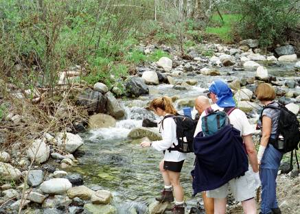 The first leg of the hike is through Trabuco Canyon. The canyon is
narrow and is bounded on both sides by steep mountains. The canyon
floor is heavily forested. The overall effect is to give the region a
somewhat dark and gloomy appearance, but it is still a very pretty area,
one atypical of southern California. This and several other areas in
the region are in some ways more reminiscent of the forests in the
eastern part of the United States than of the Mediterranean climate that
prevails elsewhere. That is partly because the rainfall is much higher
on the mountain peaks than in the basin, with the runoff providing an
adequate water supply.
The first leg of the hike is through Trabuco Canyon. The canyon is
narrow and is bounded on both sides by steep mountains. The canyon
floor is heavily forested. The overall effect is to give the region a
somewhat dark and gloomy appearance, but it is still a very pretty area,
one atypical of southern California. This and several other areas in
the region are in some ways more reminiscent of the forests in the
eastern part of the United States than of the Mediterranean climate that
prevails elsewhere. That is partly because the rainfall is much higher
on the mountain peaks than in the basin, with the runoff providing an
adequate water supply.
At 1¾ miles the Trabuco Canyon Trail cuts off to the right across a wide streambed, and continues up the left side of a canyon. The trail is not visible on the streambed rocks, making it difficult to spot. Continuing straight ahead leads to the West Horsethief Trail. Both trails lead to the Main Divide Truck Trail at the summit. The Truck Trail is a dirt road that runs along the crest of the Santa Ana Mountains for most of their length.
The Horsethief switchbacks are a modern innovation, but this basic
route was originally an Indian trail that was in use long before the
Europeans arrived. The trail has remained in use ever since. In the
early west it was used for transporting stolen horses across the Santa
Ana Mountains, hence its name. [Schad]
gives a colorful history of many of the trails in this region.
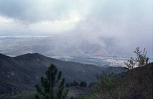 Upon reaching the top of the ridge go south on the MDTT. At some
points along the road Lake Elsinore and Interstate 15 are visible far
below. The nearby and dominant mountain visible to the northwest during
most of the hike is Santiago Peak. At 5687 feet it is the highest point
in the Santa Ana Mountains.
Upon reaching the top of the ridge go south on the MDTT. At some
points along the road Lake Elsinore and Interstate 15 are visible far
below. The nearby and dominant mountain visible to the northwest during
most of the hike is Santiago Peak. At 5687 feet it is the highest point
in the Santa Ana Mountains.
After 2½ miles on the MDTT turn right on the Trabuco Trail at a point just past a grove of pine trees. It is all downhill from there. A variety of hardwood trees, conifers, shrubs, and wildflowers decorate the path, making it one of the prettiest trails around. The lower portion of the trail clings to the steep canyon wall, providing a nice perspective on the surrounding hills and ravines.
The round trip distance is 10+ miles. The difference between the highest and lowest elevations is 2200 feet. The sum of the elevation gains is around 2600 feet. The 1100 foot ascent up the Horsethief Trail switchbacks is moderately strenuous. The grade of the Trabuco Trail is gentler, so it is easier to traverse the loop by going up the Trabuco Trail, then north on the MDTT, then down the Horsethief Trail.
The Blue Jay campground is located near the Truck Trail two miles
south of its intersection with the Trabuco Trail, so another way to hike
the loop is to stay at the campground and devote one of the days to the
hike. It is possible to drive part of the way to the Trabuco Trail, and
the road is good enough for passenger cars. A locked gate defines the
parking area. With either approach the hike requires 5½ to 6 hours.