Holy Jim Falls
 Topographic Map
Street Maps and Parking
Topographic Map
Street Maps and Parking
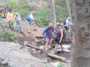 This hike is only 3.2 miles round trip and with a 650 foot elevation
gain, but after the rainy season it is more difficult than the
statistics imply, as there are innumerable stream crossings which
require hopping from one rock to the next. At that time of year wear
boots that are either water repellent or that you don't mind getting
wet. After a while you will just give up on the gymnastics and wade
through the shallow water.
This hike is only 3.2 miles round trip and with a 650 foot elevation
gain, but after the rainy season it is more difficult than the
statistics imply, as there are innumerable stream crossings which
require hopping from one rock to the next. At that time of year wear
boots that are either water repellent or that you don't mind getting
wet. After a while you will just give up on the gymnastics and wade
through the shallow water.
This canyon is one of the lushest areas in southern California. The
groves of trees that resemble birch trees are alders, and wild fig trees
are found all along the course. They are descendents of trees planted
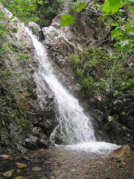
by the early settlers. The trail ends at a small waterfall that is best
visited in spring, while it is still being fed by the runoff from the
seasonal rains. It cascades down about a 15 foot drop. After
months of hot and dry weather it would only be a trickle.
 Just before reaching the waterfall the main trail branches to the left.
It is marked by a sign showing the route to the Main Divide road. It is
a hard climb from there to the top of the ridge.
Just before reaching the waterfall the main trail branches to the left.
It is marked by a sign showing the route to the Main Divide road. It is
a hard climb from there to the top of the ridge.
It would be possible to drive to the trailhead in a passenger car with
reasonable ground clearance if it has not rained for several months, but
that is only for the adventuresome. Others should use high clearance or
four wheel drive recreational vehicles.
Home