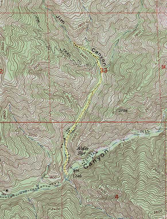
This map is a portion of the USGS Santigao Peak 7.5' topographic map, last revised in 1988. The trail to the waterfall is highlighted in yellow. The last leg of the hike is not shown on the official map. I have added it from GPS data. The trail to the Main Divide road is shown on the original map, taking off to the left about 0.3 mile from the waterfall.