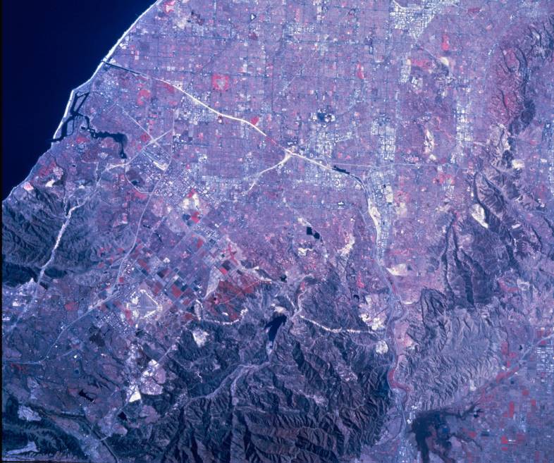
This photograph was taken from 144 miles altitude on a Space Shuttle flight in October of 1995. North is approximately to the right. The image is in false color, meaning that water is black and vegetation is red. (Red is really infrared).
The Puente hills are at the top right. The Chino Hills extend from the bottom right up to near the Puente Hills. The 57 freeway goes through the pass between the two sets of hills. It is faintly visible on the south side of the pass. Notice the distinct scaring pattern that permeates these hills, especially in the Carbon Canyon area. The Whittier fault passes through the Puente Hills and along the southern part of the Chino Hills. The southern side of the hills moves northwest at about 3 millimeters per year faster than the northern portions.
The east-west valley at the bottom right defines the northernmost extent of the Santa Ana Mountains, which extend southward from there almost to the ocean. The 91 freeway and the Santa Ana River pass through the valley. The Santa Ana River flows westward from there to near the center of the image, then to the left (south) to the Pacific. It enters the ocean about 1 image inch above Newport Bay. The 55 freeway can be seen midway between the river and the bay. It is crossed by the 73 and 405 freeways. The ponds along the river near the center of the image are to help replenish the aquifer that supplies more than half of the water for this region. The large lake on the west side of the Santa Ana Mountains and near the center of the image is Irvine Lake.