 Access Roads and Parking
Topographic Map
Access Roads and Parking
Access Roads and Parking
Topographic Map
Access Roads and Parking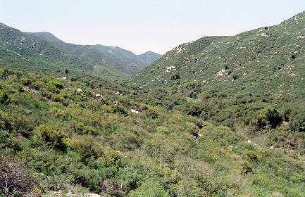 Many of the inland and
lower elevation mountains of Southern California do not receive enough
rainfall to support trees. The summers are long and dry. The hills
in this area are covered by a variety of gnarled and drought-tolerant
shrubs, frequently evergreens. Yet within this rather monotonous landscape
there are riparian enclaves where the scenery is totally different.
These two photographs were taken at points less than a mile apart.
Many of the inland and
lower elevation mountains of Southern California do not receive enough
rainfall to support trees. The summers are long and dry. The hills
in this area are covered by a variety of gnarled and drought-tolerant
shrubs, frequently evergreens. Yet within this rather monotonous landscape
there are riparian enclaves where the scenery is totally different.
These two photographs were taken at points less than a mile apart.
With a round trip distance is 2.1 miles and an elevation gain of 350
feet this hike is an easy one. Much of the trail is along the San Juan
Creek. Over the millennia the creek has eroded a channel through the
granite bedrock.
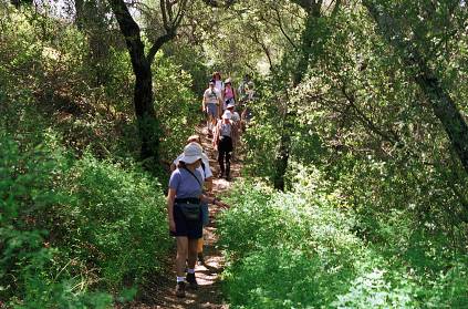
For most hikers the hike is too short to justify the drive, but the Chiquito trail joins the loop at its midpoint, and the hike can be extended by proceeding part way up that trail, and then retracing the steps. Some sense of accomplishment is lost in returning the same way, but the only other practical way of doing the Chiquito trail requires a car shuttle, so it can be a worthwhile compromise.
This area would make a good children's hike. By taking the north trail
exit from the parking lot the little gorge is only a few hundred feet
down the trail. The water probably becomes stagnant later in the summer,
but after the spring rains the rocks and the pools (but not the rapids)
make a good playground. And, upon returning to the parking lot, there
is a country store just across the road that sells candy and ice cream.