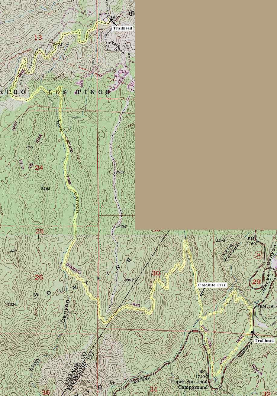
The top half of this map is a portion of the USGS Alberhill topographic map, last revised in 1988. The bottom half is from the Sitton Peak map. The San Juan Trail has been rerouted since the map was produced, so I have drawn in the current route from my GPS tracklog. It is highlighted in yellow. The Chiquito trail is highlighted as it is shown on the USGS map, and that part of the map is still accurate. The hike begins at the top right. The access road leading to the trailhead from Ortega Highway is shown on the San Juan Trail topographic map.At two miles the Chiquito trail cuts off to the left. It is marked by a sign, although someone had broken it down the last time I was there. You will cross a flat grassland area just before the trail intersection.